| Home | CV | Publications | DALO | Researcher Interest | Photos | Links | Projects | PhD Thesis | CONTACT US |
| Dr. George Papathanassiou | Geologist | |||||||||||||||
|
|||||||||||||||
|
|||||
|
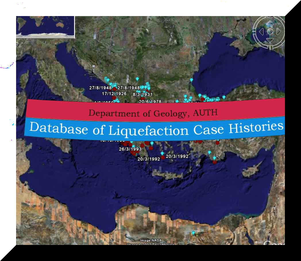
Press to view the liquefied sites and earthquake epicenter with google earth |
Η συγκεκριμένη βάση δεδομένων δημιουργήθηκε από τον Δρ. Γιώργο Παπαθανασίου, στο πλαίσιο της διδακτορικής διατριβής του στο Τμήμα Γεωλογίας, υπό την επίβλεψη των κ.κ. Καθηγητών Χρηστάρα Βασίλη, Πιτιλάκη Κυριαζή και Παυλίδη Σπύρο (περισσότερα στο users.auth.gr/gpapatha/PhD_thesis.htm). Στη συνέχεια, μετά το τέλος της διατριβής, πραγματοποιήθηκε από τον Δρ. Γιώργο Παπαθανασίου η μεταφορά της σε ψηφιακή μορφή με το λογισμικό Microsoft Access ενώ η προβολή των δεδομένων στους χάρτες γίνεται με τη βοήθεια του προγράμματος Google earth. ...περισσότερα The database of historical liquefaction occurrences has been created by Dr. George Papathanassiou during his PhD thesis in the department of Geology of AUTH, under the supervision of Prof. Christaras Basiles, Pitilakis Kiriazis and Pavlides Spyros. Afterrwards, Dr. George Papatahanssiou constructed the digital version of the database using the software of Microsoft Access while the compilation of the maps was made using the Google earth freeware.. ...more information
|
||||
|
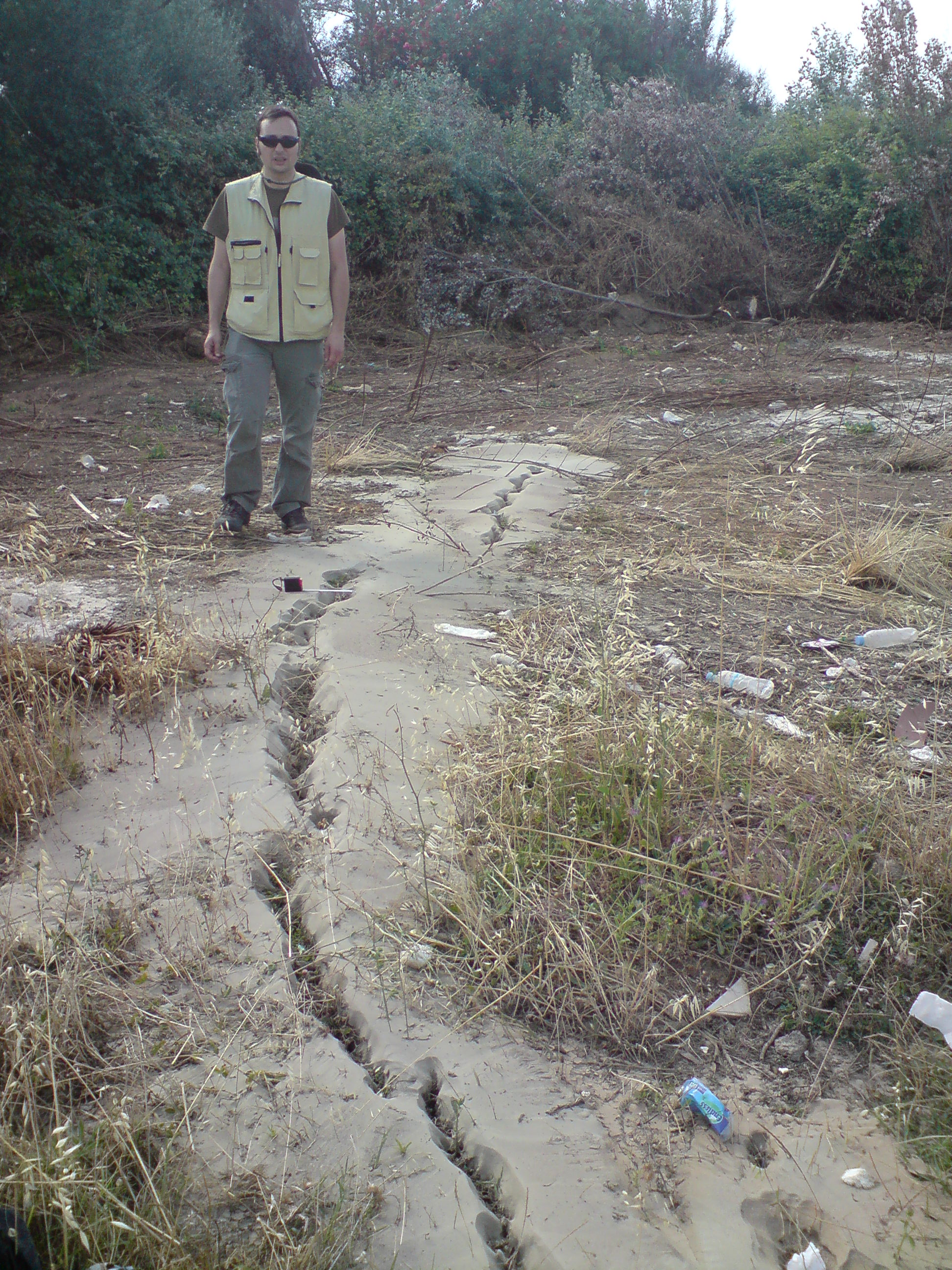
Historical liquefaction occurrences in Greece
|
|||||